[@CityPrepping] Winter 2025 Is Following a Troubling Pattern — Most People Aren’t Prepared
· 4 min read
Link: https://youtu.be/S2XTU4CDyRQ
Short Summary
Forecasters are observing a rare and concerning winter pattern for 2025/2026, reminiscent of significant cold events from over a decade ago. This setup involves a weak La Niña, warmer ocean temperatures, and an unstable polar vortex, all pointing towards a highly volatile season with sharp temperature shifts and potential for extreme weather events. This will likely lead to widespread grid strain and household impacts, emphasizing the need for proactive preparedness.
Key Quotes
Key Quotes
- "They point to a winter pattern that we have not experienced in more than a decade. The last time this setup appeared, parts of the country saw record snowfall, deep arctic outbreaks, and widespread grid strain."
- "Now, this year, we're heading into the almost exact alignment. But with warmer water temperatures from the oceans to the Great Lakes, a weak leninia, and a polar vortex already showing signs of instability."
- "This kind of agreement is really rare, but the indicators and alignments right now are that strong and exact."
- "And in preparedness, volatility is often more disruptive than uniform severity."
- "Volatility is the message that we should be getting from this. Sharp cold spells, shifting storm tracks, warm spells mixed with sudden freezes, and conditions that can strain everything from home heating to grocery deliveries."
Detailed Summary
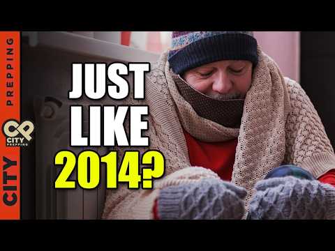
- A Decade-Rare Winter Pattern: Forecasters from Noah, Acue Weather, and climate models agree on a severe winter pattern not seen in over a decade (similar to 2010 and 2014), signaling potential for record snowfall, deep arctic outbreaks, and widespread grid strain. This year's alignment with warmer waters, weak La Niña, and an unstable polar vortex indicates a volatile winter with sharper contrasts and extreme events.
- Key Contributing Factors:
- Weak La Niña: Tends to create a more variable, wavy jet stream that dips south, sending frequent pulses of cold air across much of the central and eastern United States.
- Warmer Waters: Large bodies of water from the Pacific to the Great Lakes are warmer than usual, holding extra heat that can feed stronger winter storms.
- Unstable Polar Vortex: Early season signals similar to those preceding 2014 and 2021 Arctic outbreaks are appearing, suggesting a weakening or distortion of the polar vortex, allowing cold air to spill southward into the U.S.
- Expected Storm Tracks: The storm track is expected to be busy, with early season systems moving from western Canada into the Midwest and then toward the Mid-Atlantic and New England. As winter progresses, the track may shift from the Plains toward the Ohio Valley and into the Northeast, producing snow for the northern half of the country and a rain/snow mix for areas further south.
- Regional Weather Projections:
- Northeast: Likely to see more snowfall than last winter, though totals may still be mixed by mid-winter rain events.
- Midwest & Great Lakes: Stand out with strong potential for significant snowfall due to storm track alignment and lake effect.
- Ohio Valley & Interior Appalachians: May see an active mix of snow and ice.
- Southeast: Expected to be warmer and drier overall, but one major Arctic intrusion could still reach the Gulf Coast states late in the season.
- Texas & Oklahoma: Could experience an early snow event, followed by a quieter period, then a late-season jolt of cold.
- Southwest (CA, AZ, NV, NM): Projected to be warmer and drier than average, increasing drought and out-of-season wildfire risks, but should still expect at least one significant atmospheric river event.
- Pacific Northwest: May experience a stormy start, followed by a drying trend as winter continues, with risks of flooding and landslides early on.
- Household Impacts from Volatility:
- Energy Grid Strain: Cold spells will dramatically increase heating demand, potentially straining generation and transmission, and raising heating costs.
- Frozen Pipes: Mixed precipitation events followed by sharp temperature drops increase the risk of pipes freezing and bursting, especially in homes in the South not insulated for subfreezing temperatures.
- Transportation & Supply Chains: Repeated storm tracks will disrupt air travel, road safety, and supply chains, potentially leading to delayed grocery deliveries, reduced availability, and higher prices.
- Vulnerability in Warm Climates: Warm periods punctuated by strong Arctic outbreaks can be more dangerous than uniformly cold seasons, as people and infrastructure are often caught unprepared.
- Southwest Challenges: Warm and dry conditions increase the possibility of winter wildfires and exacerbate ongoing water scarcity issues.
- Pacific Northwest Risks: Early season heavy rain poses flooding risks, while a drier mid-winter could still bring cold, crisp nights with potential outages.
- Proactive Preparedness Steps:
- Universal Actions: Seal drafts, stage a